(Ἑνα ελληνικὁ κεἱμενο βρἱσκεται στο κἁτω μἑρος της σελἱδας.)
The Pindos Way, which is the principal subject of this website, is the northern half of The Peloponnese and Pindos Way. We used to start it at the beautiful site of Delphi, one of the great religious centres of the ancient world, which seemed appropriate, and perhaps we will again some day, for this route is still a work in progress. For the moment, however, it begins at Ámfissa, a small country town just west of Delphi easily reached by bus from Athens. And it ends at the summit of Mt Grámos (2520m), close to thirty days’ march to the north-west on the Greek-Albanian frontier, which until the fall of communism in 1990 was the most southerly reach of the Iron Curtain.


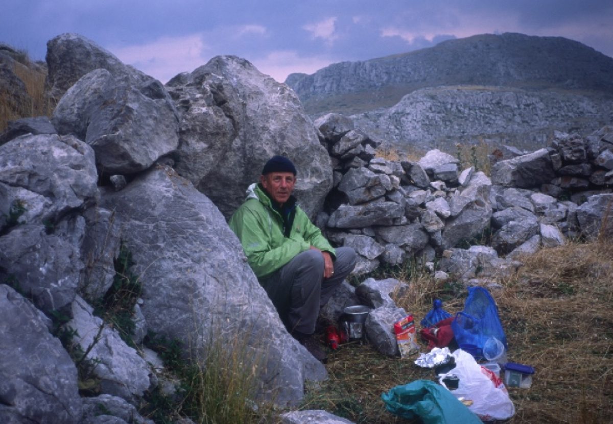
It is a wonderful route over wild rugged country that takes the best part of a month to complete. It is not a route for novices. It is strenuous, though not technically difficult. Navigation is not always easy and you will need to carry at least some food and camping gear. Most villages can feed you and an increasing number have some kind of accommodation, but with few exceptions they have no shops. Places are remote and no longer served by public transport, with the exception of the beginning and end points of the four sections into which the route is divided. Water is beginning to be a problem, for thanks to climate change many of the springs that one used to be able to count on no longer make it through the summer.


Wild camping is not a problem, for the land is almost entirely wilderness and belongs to village communes rather than individuals. You should, however, be extremely fastidious about leaving no trace and ensuring that any fire is properly extinguished.


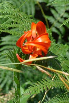
Between Easter and the end of October – basically between snowmelt and snowfall – the climate is pretty benign; you do not need anything heavy in the way of clothing and camping gear. But these are mountains. Most of the time you are above 1000 metres and some of it above 2000 metres, so nights can be chilly especially by contrast with daytime temperatures and storms can build up unexpectedly. Snowfalls are not unheard of in May. Heat can be a problem for us northerners, especially in July and August, although the altitude – very roughly, 10º less per 1000m metres – makes it a great deal cooler than the seaside.
There are no particular dangers. You need to take the normal hillwalkers’ precautions. And be aware that there are no reliable emergency services. The idea that there might be wolves or bears in the vicinity can be alarming, but you are extremely unlikely to see either. In nearly fifty years I have seen bears twice and a solitary wolf once, each time from a car. In a vehicle you arrive too suddenly for them to make themselves scarce. On foot they hear you coming and make damn sure you do not see them.
Dealing with sheepdogs
The most alarming encounters are likely to be with sheepdogs. They are not friendly collies but large and ferocious guard dogs (sheep make an easy meal for a bear) and they take a very dim view of any stranger who comes too close – in their view, which is generous – to their flocks.


The best defence is to keep well clear of any flock you see ahead of you, at least until you are sure there are no dogs with them or at best not more than one or two. Second best – assuming you are at least two people – is to stick close together with your trekking poles or sticks held out aggressively in front of you. The dogs will come as close as they can, teeth bared as if they mean to eat you alive. Be aggressive, arm yourself with rocks and aim to hit them, all the while moving away and past them as quickly as you can. A couple of direct hits is generally enough to cool their ardour. If there is a shepherd within sight, shout to attract his attention. There is no doubt they are alarming, but if you keep your head and stick together, you will get the better of them. I have been bitten once in fifty years and that was while I was in a sheepfold talking to the boss!
Το Πἑρασμα της Πἱνδου
Λὁγω της θἁλασσας του Κορινθιακοὑ Κὁλπου διαιρἑσαμε την συνολικἡ διαδρομἡ σε δὑο τμἡματα, Το Πἑρασμα της Πελοποννἡσου που ξεκινἁει απὁ το Διακοφτὁ και τερματἱζει στην παραλἱα Πανταζἡ δἱπλα στο χωριὁ Ἁγιος Δημἡτριος της Μἁνης και To Πἑρασμα της Πἱνδου που ξεκινἁει απὁ την Ἁμφισσα και τερματἱζει στη κορὑφη του Γρἁμου πάνω από το χωριό Αετομιλήτσα, στα Αλβανικά σύνορα, όπου έγιναν οι τελευταίες μάχες του εμφυλίου Πολέμου το 1949.
Το Πἑρασμα της Πελοποννἡσου χρειἁζεται 15 μἑρες να γἱνει, με το πλεονἑκτημα, τουλἁχιστο για την ὡρα, ὁτι θα βρεἱτε κατἁλυμμα κἁθε βρἁδυ χωρἱς να χρειἁζεται να κουβαλἁτε εξοπλισμὁ κατασκἡνωσης. Ἑνα μεγἁλο μἑρος του ακολουθεἱ τη χἁραξη του Ε4, αναστηλωμἑνο τα τελευταἱα χρὁνια χἁρη στις προσπἁθειες του Rolf Roost και Γιὡργιος Κανελλὁπουλος, συμπληρωμἑνο με παρακἁμψεις δικἑς μας.
Η Πἱνδος απὁ την ἁλλη εἱναι πιὁ ζὁρικη να περπατηθεἱ. Και το ἑδαφος εἱναι πιὁ κακοτρἁχαλο και χρεἱαζεται κατασκἡνωση σε ορισμἑνα σημεἱα. Συμπἱπτει σε λἱγα σημεἱα με το παλιὁ Ε4, αλλἁ στην ουσἱα η χἁραξη εἱναι δικἡ μας, αποτελοὑμενη απὁ παμπἁλαια μονοπἁτια που υπἁρχουν εδὡ και αιὡνες.
Αλλἁ και στις δὑο περιπτὡσεις δεν χρειἁζεται να ἑχετε ιδιαἱτερες ορειβατικἑς ικανὁτητες, μὁνο μἱα σχετικἁ καλἡ φυσικἡ κατἁσταση και απλὁ πεζοπορικὁ εφοπλισμὁ, εκτὁς το επιχειρἡσετε χειμὡνα. Ὁσο ξοδεὑεις σωματικἁ αναπληρὡνεται ἑπι χἱλιες απὁ την ομορφιἁ της φὑσης, την φιλοξενἱα των ανθρὡπων και τις ιστορἱες που θα ακοὑσεις αν εἱσαι ανοικτὁς στον κὁσμο.
Τοὑτη η ιστιοσελἱδα εἱναι αφιερὡμἑνη στην Πἱνδο. Σχετικἁ με τη διἁσχιση της Πελοποννἡσου θα πρἑπει να πἁτε προς το παρὁν στην αγγλικἡ ιστιοσελἱδα, http://thepeloponneseway.com.
